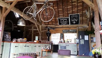
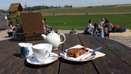
C2C = Cycle to Cafe. Circular routes from Goring designed as much for a friendly cafe or two as for the lovely scenery and enjoyable riding.
Abingdon via The Ridgeway
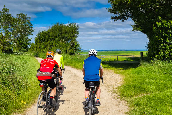
Out to Abingdon via The Ridgeway and Sustrans routes 544 and 5, returning along flat bridleways.
Highlights
The views from The Ridgeway and the bridleway down to Upton
The ancient riverside town of Abingdon
Hazards
The Ridgeway is steep and stony in parts. Some of the ruts are very deep. The exposed chalk is very slippy when wet.
Hospitality
Lots of choice around the square and by the river in Abingdon.
The Snug at Bishop’s Court Farm is just off-route in Dorchester and has a signposted detour along its own farm road.
Cafes, shops and pubs in Benson.
Hints
The bridge where the route crosses the backwater at Days Lock was used for the annual World Poohsticks Championships from 1984 to 2015.
Two Horses
The Valley of the Racehorse and The Vale of White Horse
Lambourn styles itself as “The Valley of the Racehorse”. This route follows the valley to the top of the Downs, then returns via the Vale of White Horse. There’s even a quintessential English pub called The White Horse, and a view of the legendary horse itself.
Highlights
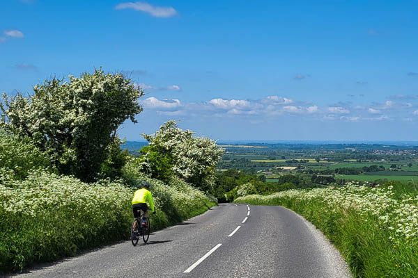
A gentle climb over the Downs on the quiet B4000 west of Lambourn.
The view from the top of Ashbury Hill
The view from Walbury Hill.
Hazards
The route takes “the back way” to avoid Streatley Hill, which has a gradient of 15% and can be quite busy. The direct route is a mile or two shorter.
Hospitality
Goodies cafe in Lambourn at 27 miles
Village shop and cafe in Ashbury at 34 miles
The White Horse, a perfect English pub in Woolstone at 37 miles
Hints
The historic White Horse on the shoulder of the Downs can be seen from the route just west of Uffington.
Chinnor and Kingston Blount
Along the foot of the escarpment, before taking on one of the Chilterns’ classic climbs
“Only one climb of any significance” – but what a hill. As steep and as long as Streatley Hill, but not nearly as well known.
The route meanders along the “foothills” below the Chiltern Escarpment, before turning south-east for the climb. There’s a chance for refreshment in Chinnor shortly before the climb.
Highlights
The climb from Kingston Blount to Stokenchurch – a mile long with a maximum gradient of 18%.
Extensive views across South Oxfordshire after the top of the climb.
Hazards
The short stretch of the B4009 from Chinnor to Kingston Blount is quite busy. This could be avoided by turning right in Sydenham, making a shorter route, but missing the cafes in Chinnor.
Hospitality
There are a number of cafes in Chinnor. The Cherry Tree in Kingston Blount was formerly a pub, now a cafe and B&B, but it is closed on Mondays.
Village shop in Ewelme. Other cafes and pubs in Chinnor.
Hints
An alternative way up the escarpment is to take the A40 up Aston Hill, just to the west of Kingston Blount. This has a gentler gradient. Because it is close to the M40 it does not usually have much traffic, but is wide and has a good surface.
Hambleden Valley
A steady climb from Goring to Christmas Common is followed by long descent into and down the Hambleden Valley, one of the Chilterns’ most picturesque areas and much-used as a film and TV location.
Highlights
Over a mile of freewheeling down Dolesden Lane from Turville Heath towards Turville.
The beautiful Hambleden Valley and nearby mill and lock on the River Thames.
The River Thames waterfront at Henley.
Hazards
The initial part of the descent from Turville Heath is quite twisty, but then straightens out for an enjoyable descent.
Busy traffic in Henley.
Hospitality
The Café in the Barn at Turville Heath (16 miles) – walkers and cyclists only – no cars allowed. Check for opening hours .Reservations are required.
Hambleden Village Shop (21 miles) also sells tea, coffee and cakes. It is open 7 days a week but there is limited inside seating.
The Chocolate Café in Henley (25.5 miles) is directly on-route, facing the river just after the traffic lights. It is under the same ownership as the Village Café in Goring. There are a number of other cafes and pubs in Henley a short distance off-route.
Cafe in Sonning Common – no website (31 miles).
Hints
For an alternative route from Goring to Christmas Common via Swyncombe instead of Woodcote and Checkendon, see The Barn at Turville Heath.
This route takes a traffic-free path out of Henley. Turn left past the railway station and follow the path between the railway and an industrial estate. It then follows the Harspden Valley, which has a short sharp climb at the end of it. For an alternative route back to Goring via Rotherfield Greys, see The Assendon Valley.
The Barn at Turville Heath
Through the Chilterns to the locally-famous No Car Cafe, with plenty of climbing to work up a good appetite.
The Barn at Turville Heath proudly markets itself as a “No motor vehicle cafe”, so what could be a better destination for a bike ride, particularly when it’s in the heart of the Chilterns beech woods? It’s become a victim of its own success, limiting its opening hours and requiring reservations in advance.
Highlights
The cafe in the barn, a mix of quirkiness and friendliness.
Lots of beautiful woodland.
The traffic-free tarmac bridleway through the parkland of the Nettlebed Estate.
Hazards
Steep and rough descent from Fawley to the Assendon Valley.
Crossing the busy A4130 at Bix.
Hospitality
The Barn at Turville Heath
Stoke Row Village Store
Post Office and Village Shop just off the route in Ipsden
Hints
The last 200 m to the barn is along an unsurfaced track. Riders concerned about their tyres can walk.
Nettlebed Estate
A loop through the Chilterns taking in a tarmac traffic-free bridleway through the Nettlebed Estate
An undulating (but not too steep) ride through the Chilterns, taking in 1.5 miles through the Nettlebed Estate on a bridleway with a beautiful tarmac surface.
Highlights
Traffic-free route through the Nettlebed Estate from Bix to Satwell.
The Maharajah’s Well in Stoke Row.
Hazards
Some speed bumps on the bridleway across the estate
Steep downhill on Colliers Lane after The Unicorn pub, with loose gravel and a sharp bend at the bottom.
Fast traffic for a short distance on the A4130 at Bix (but the road is wide, straight and has a central reservation).
Hospitality
The Unicorn (7.5 miles) and The Red Lion (8.2 miles) pubs in Peppard Common.
The Rising Sun pub at Witheridge Hill (14.2 miles).
The Cherry Tree pub (15.0 miles)
Stoke Row Village Store and Café (15.3 miles).
Hints
This route makes left turns on and off the busy A4130 for a short distance. Following the route in the reverse direction is not recommended.
For shorter rides to Stoke Row, see The Cherry Tree or The Maharajah’s Well routes.
The Maharajah’s Well
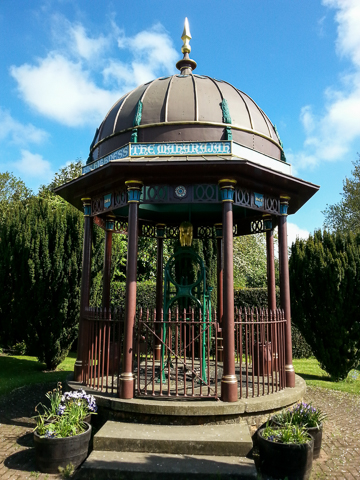
From Goring to the Maharajah’s Well in the village of Stoke Row and back.
The Maharajah’s Well was a gift to the village of Stoke Row from the Maharajah of Benares. It was completed in 1864, at a time when many of the villages in the Chilterns did not have a reliable source of safe drinking water.
Highlights
The unique Maharajah’s Well with its gilded elephant.
Hazards
The A4074 is often busy with high-speed traffic, but visibility at the junction with this route is good.
Direct, loose gravel and potholes on the narrow lanes, particularly on the second half of the route.
Hospitality
The Village Store in Stoke Row is almost opposite the well, includes a cafe, and is open Monday to Saturday.
The Cherry Tree pub in Stoke Row is 500m to the east of the well, along the route.
The Black and Red Lion pubs in Woodcote – one on each alternative route
Village shops in Stoke Row and Woodcote
Hints
There are two routes through Woodcote – along the “main” roads, which pass the shops, and round the back, which involves a little more climbing.
Nuffield and Ipsden
Up along and down the Chiltern escarpment
A steady climb through Woodcote and Checkendon to Nuffield, then a fast whizz down Brixton Hill. Watch out for the “evil dip” at Ipsden on the way back.
Highlights
Lovely views from where the route crosses the Ridgeway Long Distance Path in Nuffield, and on the return through Ispden. Over a mile of freewheeling from Nuffield down Brixton Hill.
Hazards
Brixton Hill is one of the fastest descents in the area, so watch out for other traffic. However the visibility is generally good.
There is a very steep dip into and out of the valley at Ipsden village, with a bend in the road and a junction at the bottom.
Narrow lanes with loose gravel and potholes, particularly between the bottom of Brixton Hill and the crossing of the A4074.
Hospitality
Shops and pubs in Woodcote.
The Black Horse pub is 400m north-west of the route just beyond Checkendon.
Maker Space @ The Crown cafe (in the former Crown pub) is 800 m beyond the junction at Nuffield, and can be accessed via a track across the golf course
The King William IV pub is 400m east of the route at Hailey, just north of Ipsden, and is signposted from the route. It has a lovely view across to the Berkshire Downs.
The village shop in Ipsden is a few metres off the route at the bottom of the Ipsden dip.
Hints
The Brixton Hill descent comes in two parts, with a flatter section between the two. You can probably freewheel all the way, providing there is not a strong westerly headwind. If you can’t, check your brakes and/or wheel bearings.
Used in reverse, this route provides a good training ride because of the climb up Brixton Hill.
Saddleback Farm Shop
A climb through the Downs to the Saddleback Farm Shop
The Saddleback Farm Shop is a butchery, deli and tea room run by Manor Farm in Brightwalton. It makes a rewarding destination for an undulating ride along some very quiet roads to the west of Goring and Streatley.
Highlights
Frequent sightings of herds of wild deer from outside the cafe.
Long swooping descent from Farnborough on the return.
Fine views across the open downs near The Ridgeway.
Hazards
Streatley Hill is a very steep descent, with blind bends and traffic lights at the bottom. The outward route climbs very steeply from Stichens Green to Southridge, but is much quieter.
Hospitality
The Saddleback Farm Shop.
The Hampstead Norreys Community Shop has a fine cafe and is 300m to the east of the route.
Village shop in Compton.
Hints
If you like baking, buy some Wessex Mill flour at the farm shop – grown, milled and sold locally.
Sonning Common Herb Farm
An undulating route through Chiltern woodland, with a wide variety of refreshment options.
Highlights
Carpets of bluebells in the spring
Golden beech woods in the autumn
Long freewheel through the woods from Stoke Row towards Sonning Common.
Hazards
Crossings of the A4074, often busy with high-speed traffic. Visibility at both junctions with this route is good.
Hospitality
Stoke Row Village Store and Café, just 200 m off-route to the west in Stoke Row.
The Cherry Tree pub in Stoke Row.
The Unicorn pub in Peppard Common
Sonning Common Herb Farm, which does indeed grow and sell herbs as well as having a good café.
An alternative café is The Common cafe (no website) in Wood Lane, just off-route. There is also a supermarket near the café.
Hints
This is a handy route if the weather forecast looks bad, as there are a number of options to cut it short and return to Goring en route.
There’s a steep climb up “Furniture Hill” after 4.5 miles, so called by local cyclists because it passes the workshop of master craftsman Philip Koomen, who designs and makes amazing furniture with locally-sourced wood.
For other routes to Stoke Row, see The Maharajah’s Well or The Cherry Tree.